Log in
All resources
Create a design
1,256 Free Artworks of English Language
bibliothèque nationale de france
english-language maps
maps by thomas kitchin
thomas kitchin
eran laor cartographic collection
charles william meredith van de velde
1858 maps
1858 van de velde maps of palestine and jerusalem
maps by john cary
john cary
bibliothèque nationale de france
clément-pierre marillier
17th-century maps of london
baroque
old maps of the bay of gibraltar
18th-century maps of gibraltar
damayanti and the hamsa
swans in art of india
eran laor cartographic collection
emanuel bowen
eran laor cartographic collection
emanuel bowen
scotland's story by h. e. marshall
catherine douglas
bibliothèque nationale de france
maps by thomas kitchin
maps of bristol by braun & hogenberg
bibliothèque nationale de france
bibliothèque nationale de france
maps by thomas kitchin
paintings of arjuna
ulupi
lithographs in the british museum
english-language title pages
lithographs in the british museum
english-language title pages
christ church, oxford in art
etchings
maps by john cary
1836 maps
charles william meredith van de velde
eran laor cartographic collection
scotland's story by h. e. marshall
history of scotland
maps by thomas kitchin
1781 maps of europe
maps of the history of jerusalem
1830s maps showing history
maps by john cary
1806 maps of asia
1777 maps of south america
maps by thomas kitchin
chorographia britanniae (1741-1742)
bibliothèque nationale de france
bibliothèque nationale de france
maps by thomas kitchin
chorographia britanniae (1741-1742)
bibliothèque nationale de france
bibliothèque nationale de france
maps by thomas kitchin
john rocque's 1748 map of london and adjacent country
bibliothèque nationale de france
paintings of ganga
shantanu
illustrations by warwick goble
nala-damayanti
illustrations by warwick goble
disrobing of draupadi
antoine-françois tardieu
pierre antoine tardieu
maps indicating exploration
royal geographical society
18th-century maps of the sea of marmara
18th-century maps of the dardanelles
carte du mexique et de la floride by guillaume delisle (1703)
bibliothèque nationale de france
bethlem royal hospital
realism
a history of the town and parish of nantwich, or wich-malbank, in the county palatine of chester (1883)
english-language family trees
our empire story by h. e. marshall
j. r. skelton
old maps of the nordic region
1840 maps
maps by thomas starling
1842 maps
tipu sultan in art
j. r. skelton
1800 maps of the atlantic ocean
1800s maps of the americas
midle-sex described with the most famous cities of london and westminster (1610)
bibliothèque nationale de france
midle-sex described with the most famous cities of london and westminster (1610)
context files from gallica
an accurate map of england and wales , drawn from all the particular surveys hitherto publish'd. illustrated with many additional improvements, and regulated by numerous astronomical observations made by... - btv1b53181614s
maps by thomas kitchin
an accurate map of england and wales , drawn from all the particular surveys hitherto publish'd. illustrated with many additional improvements, and regulated by numerous astronomical observations made by... - btv1b53181614s
maps by thomas kitchin
maps by john cary
1799 maps
maps by john cary
1799 maps
chorographia britanniae (1741-1742)
bibliothèque nationale de france
chorographia britanniae (1741-1742)
england in the 1740s
bibliothèque nationale de france
maps by thomas kitchin
18th-century maps of england and wales
chorographia britanniae (1741-1742)
bibliothèque nationale de france
maps by thomas kitchin
maps by emanuel bowen
1740 maps
1750s maps of the caribbean
maps by thomas kitchin
bibliothèque nationale de france
maps by thomas kitchin
chorographia britanniae (1741-1742)
bibliothèque nationale de france
english-language books about london
old maps of the city of london
robert clive, 1st baron clive in art
j. r. skelton
baroque,dutch golden age painting
1907 books
1840s maps showing history
maps by thomas starling
maps of circumnavigations of the world
1740s maps of the world
1900 landscape paintings from denmark
paintings by august fischer
maps by john cary
1799 maps
english-language books about london
crosby hall
elephant riding in art of india
illustrations by warwick goble
our empire story by h. e. marshall
j. r. skelton
illustrations by warwick goble
indian myth and legend (1913)
old county maps of hertfordshire
maps by thomas kitchin
geological maps of england
william smith (geologist)
maps of saint paul's journeys
maps by thomas starling
1710s maps of the world
maps by edward wright
18th-century maps of edinburgh-shire
maps of scotland by herman moll
the history and antiquities of london, westminster, southwark and parts adjacent
english-language books about london
henry william bunbury
the gout (gillray)
athletics at the 1906 summer olympics
the olympic games at athens, 1906
english-language maps
maps by john cary
maps by pieter mortier
maps from gallica
1930 film posters of the united states
greta garbo in 1930
pierre antoine tardieu
maps from gallica
1700s maps of germany
battle of blenheim
a topographical map of the county of berks (1761)
bibliothèque nationale de france
a topographical map of the county of berks (1761)
bibliothèque nationale de france
a topographical map of the county of berks (1761)
bibliothèque nationale de france
maps by john cary
county of tyrol
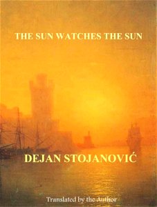
books by dejan stojanović
romanticism
1858 van de velde maps of palestine and jerusalem
eran laor cartographic collection
18th-century maps of the malay archipelago
1790s maps of china
chorographia britanniae (1741-1742)
18th-century maps of sussex
dutch golden age painting
1907 books
military history of the mughal empire
j. r. skelton
18th-century maps of the mediterranean sea
1745 maps
1858 van de velde maps of palestine and jerusalem
eran laor cartographic collection
1858 van de velde maps of palestine and jerusalem
eran laor cartographic collection
1858 van de velde maps of palestine and jerusalem
eran laor cartographic collection
1858 van de velde maps of palestine and jerusalem
eran laor cartographic collection
1858 van de velde maps of palestine and jerusalem
eran laor cartographic collection
1858 van de velde maps of palestine and jerusalem
eran laor cartographic collection
1858 van de velde maps of palestine and jerusalem
eran laor cartographic collection
1858 van de velde maps of palestine and jerusalem
eran laor cartographic collection
1858 van de velde maps of palestine and jerusalem
eran laor cartographic collection
401 - 500 of 1,256
Next page
/ 13